Welcome the April updates! Based on our partners' feedback, we keep on adding new features on a regular basis. It’s now possible to download pictures and files (collected by a field employee) from an email message. We’ve also added new instant alerts to give your clients peace-of-mind when leaving a vehicle unattended. And, of course, we will reveal newly integrated GPS tracking devices and integration improvements. By the way, today nearly 800 devices are available on the platform!
Here’s a summary of the main updates that have rolled out in the last few weeks.
Receive pictures and files from “fields” by email
In the previous post we’ve already told you about “Attachments” — a feature aimed at speeding up the process of data exchange between field employees and the office. Just in a few clicks, mobile employees can add comments, attach pictures, files and electronic signatures to a form. All the data will be immediately sent to a supervisor or the head of the office for further processing and analysis.
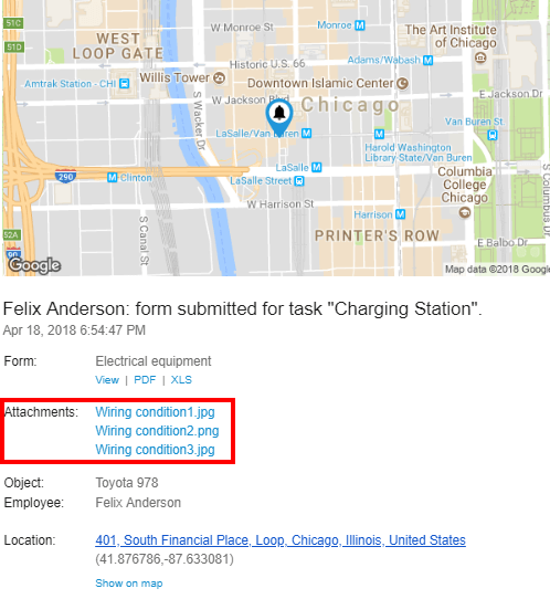
We continue to improve the Forms functionality. Now all the photos and files attached by mobile employees to a form can be downloaded directly from the notification email messages. This will help to speed up the processing of results by a back office.
New instant alerts for vehicle safety and mobile employees control
The users can now receive new instant alerts on important events.
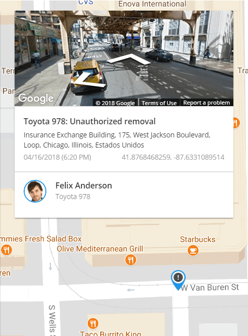
“Auto geofencing”. Once the ignition is turned off, a geofence will be automatically created. This way, the alert is triggered each time a vehicle enters or leaves customized areas with deactivated ignition. For example, users will be immediately notified about a vehicle being towed and thus avoid paying towing and storage fees.
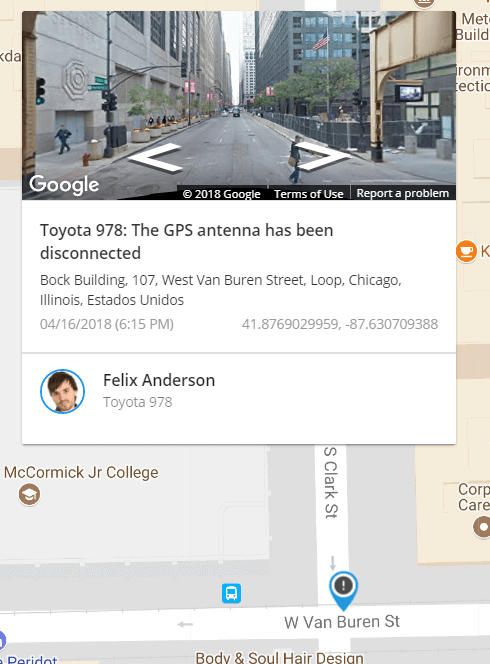
“GPS antenna disconnected”. By receiving this alert, vehicle owners, operators and supervisors will be able to immediately react on an external GPS antenna detachment and fix the problem.
Add texts and hyperlinks to “points of interest” (POI)
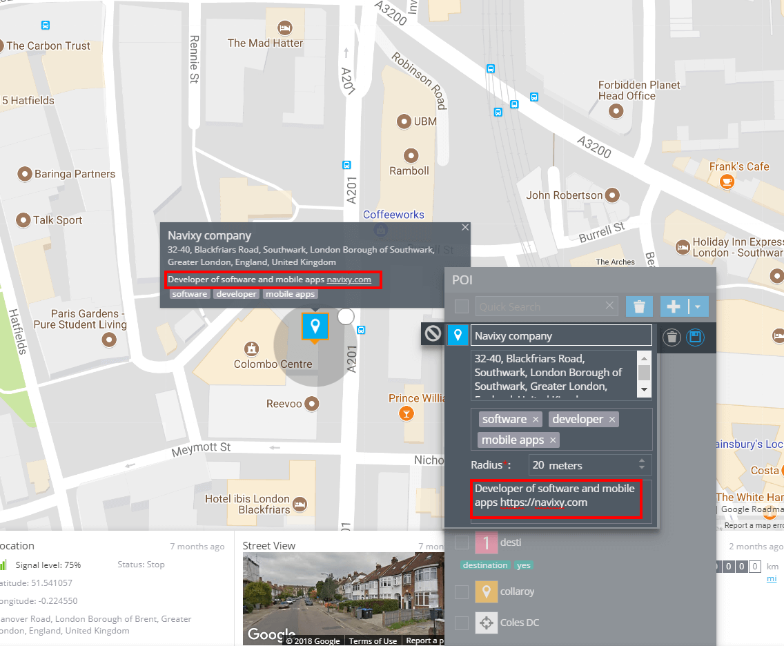
The “Points of Interest” (POI) tool now includes a “Description” field. Users are now allowed to insert not only tags but also texts and hyperlinks to an external website or other resources.
For example, if you plot a client as POI, it’ll be possible to add a brief company overview and a weblink.
Navixy speaks Sinhalese language: 18 languages now included
We’ve added Sinhalese/Sinhala language, which is one of the two official languages of Sri Lanka. Today the platform supports 18 languages spoken by more than half of the world’s population.
Currencies of more than 120 countries supported
Navixy's services are rapidly expanding around the world. We are proud and honored to have received positive feedback and new suggestions from our clients during international exhibitions in Dubai and Mexico. Today we have more than 500 partners from 114 countries. Each time announcing the system updates, we are happy to see the list of supported currencies and languages continuously growing.
Kuwaiti dinar has been included to the platform. Navixy now supports currency of more than 120 countries. Thus, you can easily adapt your monitoring platform to meet specific customer needs.
Integrated devices
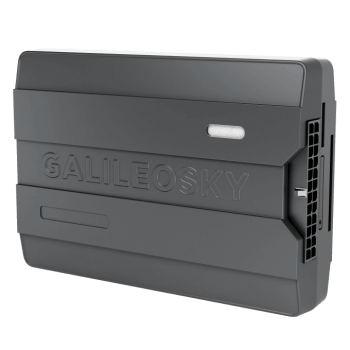
Today Navixy is about to reach 800 integrated devices. We keep close links with leading manufacturers worldwide to provide your clients with the most recent integrations of hightech devices: Teltonika FM3612 (FM3622), Galileosky BaseBlock (BaseBlock Lite), Novatel MT 4100 U, Concox AT3, Jointech GP6000, Aplicom A9 NEX and others. You can see the full list of supported devices by clicking here.
We are also ready to present you some new functions implemented in the already integrated devices. Let’s have a look at the most vivid and significant ones:
Navixy has long been on friendly terms with Easy Logic — a technology for custom programming developed by Galileosky. Thanks to Easy Logic, an integrator can independently set a separate algorithm of actions for each Galileosky tracking device. For example, making and sending a photo, when an alarm button is pressed, or blocking the engine when exiting a geofence.
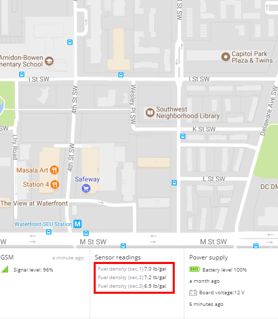
What has changed is that now users are able to receive the results of calculations based on the Easy Logic algorithms and view them right in the monitoring system interface.
Let’s take a real-life example and see how it works. Our partner has a customer who has a fleet of fuel trucks and drivers that deliver fuel from point A to point B. The client requested the possibility to control fuel density in order to know whether his drivers are draining fuel from the tank, or that are the temperature conditions that make it decrease. The process is really simple: set a separate algorithm of actions for a GPS tracker to make the needed calculations. In this case the driver had a Galileosky v7 device installed. Based on the fuel type and temperature, a GPS tracker calculates the fuel density, and then sends this data to a monitoring service.
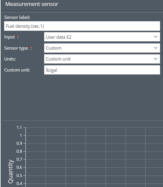
To receive and view fuel density values you just have to add a new measurement sensor and choose the data source “User data”.
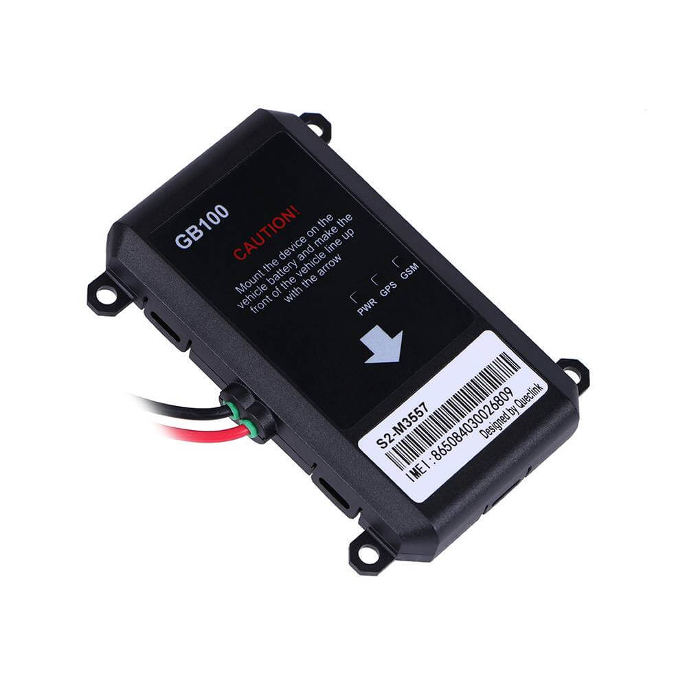
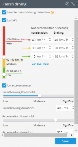
Queclink GB100. Fine-tune the “Harsh driving” feature right from the interface using the visual portlet. Put in the acceleration/braking values in the fields or move the slider to adjust a motion sensor sensitivity.
You can find out more about Queclink GB100, a GPS tracker that is positioned as an effective instrument for insurance telematics and vehicle leasing in our detailed overview.
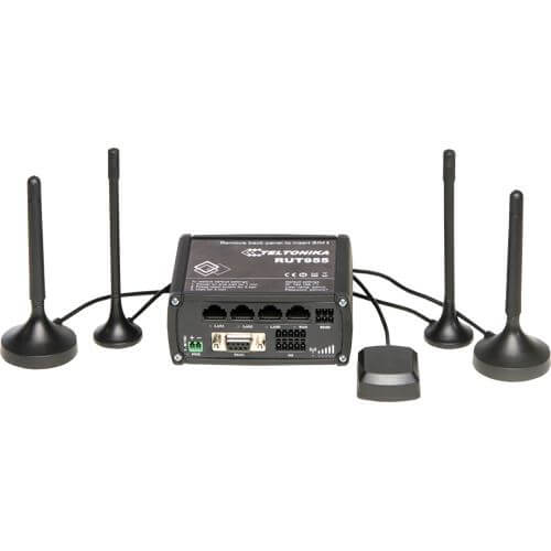
Teltonika RUT955 is indeed worth looking at. This is a 4G/LTE dual SIM router with GPS, WiFi, external antennas, 2 digital inputs, one analog output, and RS232/RS485 interfaces. The device is perfectly suitable for M2M/IoT applications.
This GPS router can be easily installed on cars, buses, trucks or any other vehicle. It also supports DIN rail mounting option.
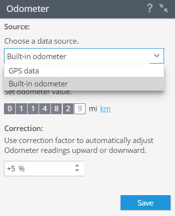
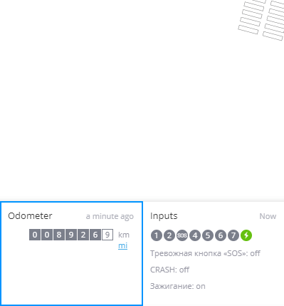
Teltonika FMA120. Now the mileage data taken from the device built-in odometer can be transferred to the platform. Using this model, users are allowed to choose a data source: GPS data, CAN-bus or built-in odometer.
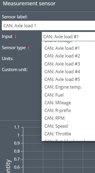
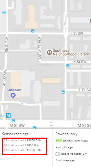
BCE fm 500 blue+ received integration improvements: it’s now possible to receive and view axle load data. This way, the device is able to read FMS CAN data from vehicles. This GPS tracker is ideal for professional vehicle monitoring: it has 7 inputs (digital and analog) and 3 outputs for remote control of external equipment.
Try the new features and leave feedback in the comments or contact our managers. Follow the system updates. Subscribe to our Facebook and Twitter to stay in the loop.
