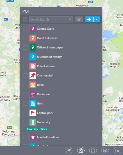
Points of Interest (POI) is a very useful feature as for organizations so for end users. Any user can create a list of POIs for his or her convenience - it can be just a couple of places (like home, work, supermarket, etc.) or include hundreds of POIs (for needs of the logistic manager).
There are several parameters you can set for each POI:
- Name. You can use any name you want, like Office, Warehouse or Accounts Department - choose a label that fits your purposes and will help you find your POI easily.
- Icon. You can use any picture from the library or upload it from your PC.
- Tags. Tags are used to work with big amount of POIs and are very helpful if you have more than several dozens POIs. There’s no limit in the quantity of tags, and the same POI can be identified by several tags.
How do I create and edit POIs?
- In order to create a new POI, right-click on the map and press "Create place" button.
- If you want to see the list of already created POIs - use the map tool “POI” on the right side of the tools panel.
What do I need POIs for?
- Finding objects on the map - you don’t have to specify the whole address anymore. Just type the name or tag you assigned to the POI and you’ll have the list with all the matches.
- Creating routes and geofences - you can easily find place on the map and draw a circle or polygon. You can also create a route between several POIs, let’s say between your office and warehouse.
- Assigning tasks to the employees - instead of the whole address of their destination you can just use the name of the right POI and our system will create the task.
Importing POIs
It’s useful to upload a large amount of POIs from Excel file rather than create them manually one by one. For that purpose you’ll need an XLS, XLSX or CSV file.
In order to start importing from the file - choose the “POI” tool and click on “Import from Excel file”.
You’ll be able to download the example of the Excel file and specify the geocoder.
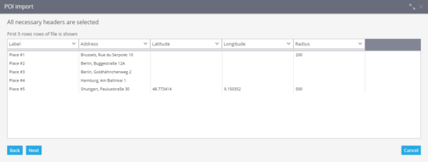
After downloading the file - fill in the following columns:
- Name
- Address
- Latitude
- Longitude
- Radius
After you’ve filled in all the columns - save this file on your PC.
In order to upload the file, click on “Select” button in the "POI Import" window and find the file on your PC. After you’ve pressed "Next" button - the window with the column names will appear. After checking that everything is correct you can proceed to the next step.
If some data is missing - the system will offer you to specify it. If any blank fields left - the record is not going to be imported.
If all the data is correct - your points of interest will appear in the list.


